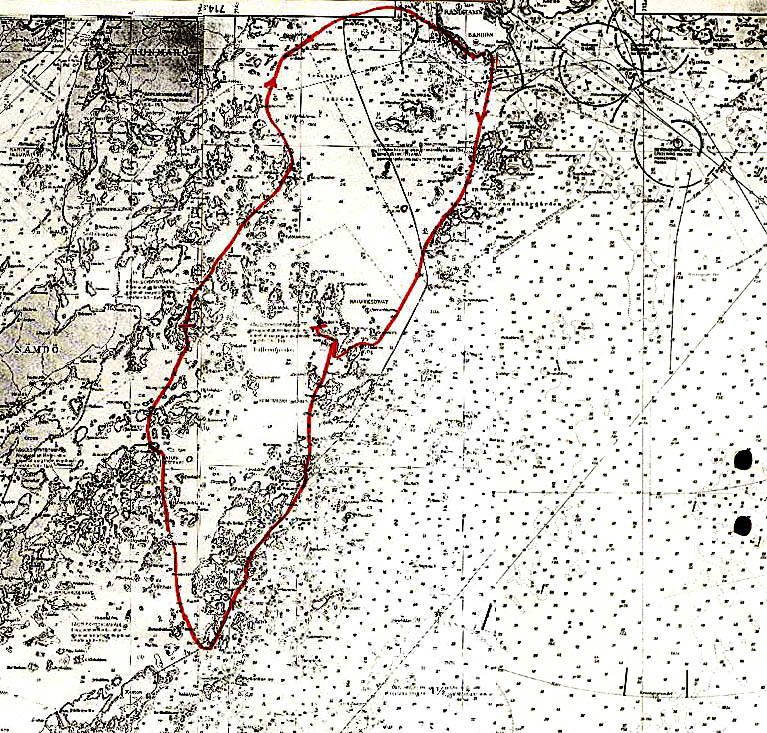
It is an overcast early afternoon in July, and we are about to launch from a small sandy beach at Sandhamn, about 30 nautical miles east of Stockholm, Sweden. This is at the outer edge of an incredibly rich archipelago, recently proposed as a World Heritage Site. Close to Stockholm the islands are big and heavily wooded, and the waters quite protected. There many beautiful old homes dot the shoreline, which is still predominantly green. Further out the waters are increasingly more open and the islands smaller, but still they are mostly wooded. We are headed for the outer fringes, where the islands become rocks and skerries and trees are scarce.
This is a kayaker's delight, with sheltered coves almost everywhere. There is no tide and hence no serious currents (often quite windy, though). Sandy beaches are rare, but it is easy to pull your kayak up on the smooth rocks. (No barnacles or oysters! The brackish water does not support these types of aquatic animals.)
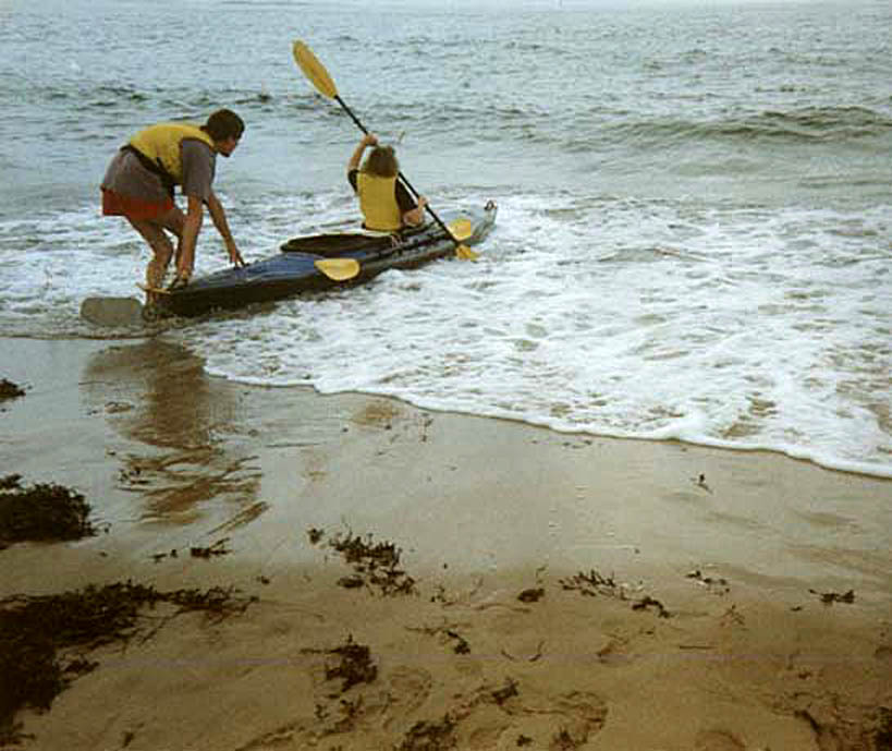
But today the Baltic looks threatening, with big breakers pounding the small beach (not big for people used to Pacific surf, but big for our experience). With 32 knot winds we had wisely opted to stay on shore yesterday. But today there is no wind. My family looks on in apprehension as Surain gets in to the front cockpit of our Nautiraid Raid II Expedition foldable kayak. I had assured everybody that it would be easy to launch from here. Not until we reached the small beach did I realize that this was bigger surf than we had ever handled before.
With the correct timing, it would still have been fairly easy. However, I misjudge and as we push out from shore Surain in the bow is washed in two consecutive breakers. The forecast had promised partly sunny weather, but the clouds stay with us. We follow the outer skerries south, partly sheltered, and partly exposed to the swells of the ocean. We both love big swells, where you are buried in a trough seeing just water around you one moment, and the next moment are lifted to a grand view. Shoals abound around us, so I navigate with care. The raging foam will reveal most of the shoals, but there can be rogue waves and we are paddling a fragile craft.
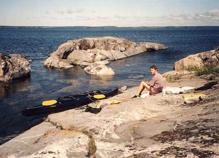
After a couple of hours we reach Bullerö, one of many nature preserves. We paddle past the harbor and the yachts, to a small private cove. It is hard to find a space for the tent. Rocks, rocks, rocks and few areas with soil. We lay one lifejacket under the tent to shelter it from some moist grass. The rain arrives. After an hour we get tired of sitting in the tent, so head out to explore the island despite the rain.
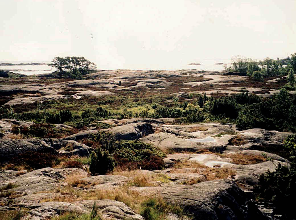
The vegetation is quite unlike lush Stockholm. The constant wind only allows hardy plants to survive, making it look more like subarctic Lappland (northern Scandinavia). Lichen, moss, heather, low-growing juniper looking like heather and low shrubs abound anywhere they can find a foothold in this landscape of granite and gneiss. It was formed by a two mile thick glacier slowly moving south, grinding the north-facing rocks to an incredible smoothness. The land is still recovering from the weight, though the ice melted more than 10,000 years ago. In 100 years the land will have risen another foot and a half from the ocean.
Where there is a sheltered pocket, there may be a 100 square foot area of rich vegetation, maybe supporting the single tree on some skerries. Bullerö is comparatively large, with some long valleys with fairy tale-like virgin forest. We walk in amazement, feeling like Alice in Wonderland.
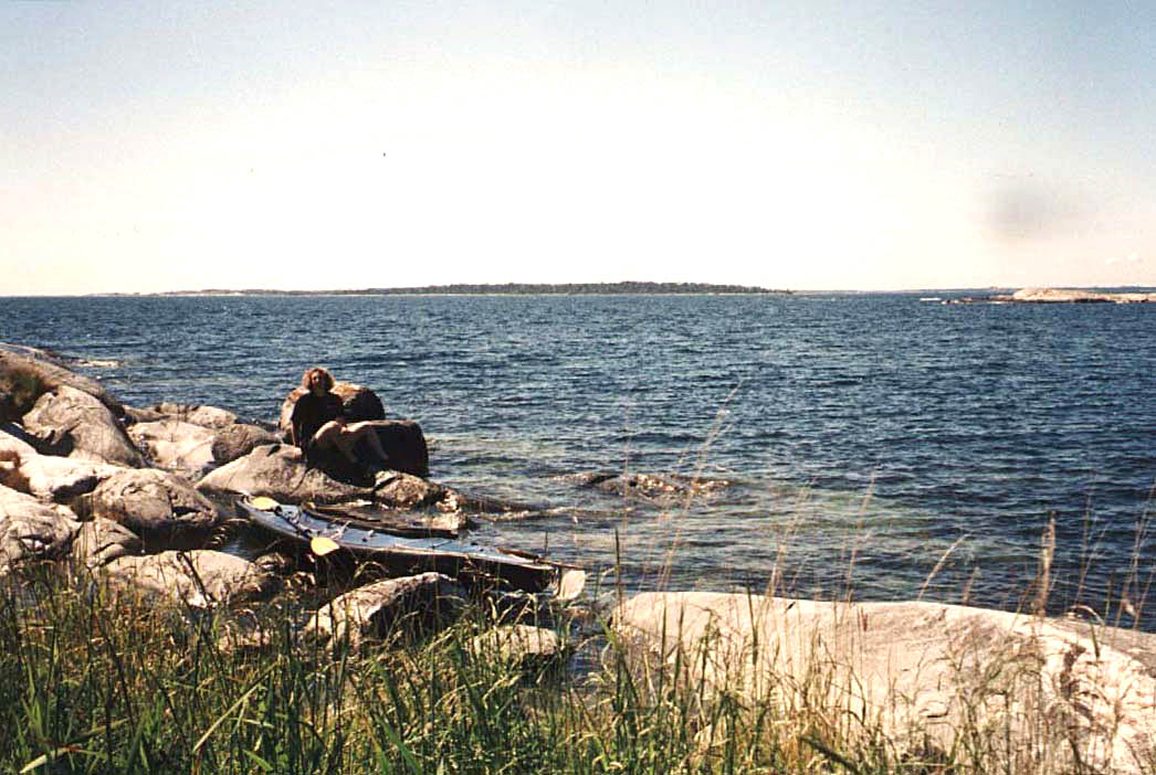
The next day the weather lives up to the forecast, with beautiful clear skies. The sun has already been shining several hours when we get up at 7. The swells from yesterday are gone, and we can venture where no other craft dares go, darting in and out between the skerries and innumerable shoals. The eider is the predominant bird here, but we also see many gulls, stately swans, diving terns, posing black guillemots, beautiful herons, and more.
After lunch we turn north, heading through a maze of islands sheltered from the ocean. We see a few kayaks and many sailboats with their white sails. We are glad that powerboats are rare here. A nice little cove invites us to spend the night. Here a little bit away from the ocean it is easy to find a good tentsite. The very slowly setting sun fries us relentlessly, so we take a dip in the still chilly water.
The third morning presents yet another type of weather - dense fog. Strangely enough, in certain ways it facilitates navigation. By judging how clear the islands appear in the fog, you can tell their relative distance. In clear weather and from the low vantage point of a kayak, the islands merge. There are few other boats out the first few hours. We glide through a seascape that looks like a painting. When we step ashore on a seemingly abandoned island, we meet a sailor who complains about the swells, making her night on a sailboat miserable. No such problems with kayak camping! The fog eventually lifts and we push on to make it back to Sandhamn in time for a shower and late lunch.
Robert afSandeberg